
How to Pick a Sensor in KeepTrack
Now that you’re familiar with the basics of KeepTrack and have learned how to find a satellite, let’s explore how to pick a sensor. Currently all sensors in KeepTrack are ground-based stations that track satellites and space objects.
Why Pick a Sensor?
Sensors allow you to:
- Calculate look angles between the sensor and a satellite
- Visualize the sensor’s field of view
- Understand which satellites are visible from specific locations on Earth
How to Pick a Sensor
-
Open the Sensor List:
- Look for the “Sensors” icon in the bottom menu (it looks a dot radiating lines horizontally)
- Click on this icon to open the Sensor List side menu
-
Browse Sensor Categories:
- Sensors are organized into categories like “Space Surveillance Network” and “US Missile Warning”
- Click on a category to expand it and see the sensors within
-
Select a Sensor:
- Click on a sensor name to select it
- The view will automatically center on the selected sensor’s location on Earth
-
Explore Sensor Information:
- Look for the Sensor Info box in the bottom menu (it looks like a circle with an i inside)
- This box displays detailed information about the selected sensor
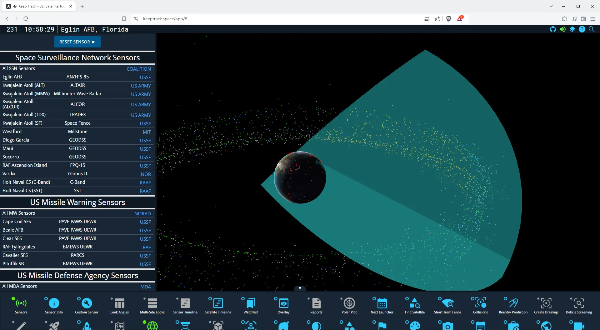
Example: Selecting the Eglin Radar
Let’s try selecting a specific sensor as an example:
- Open the Sensor List (click the radar dish icon in the bottom menu)
- Look for the “Space Surveillance Network” category and expand it
- Scroll down to find “Eglin (AN/FPS-85)” and click on it
- The view will center on Eglin Air Force Base in Florida, USA
- Check the Sensor Info box for details about the Eglin radar
Practice Exercise
Try finding these sensors on your own:
- NESS (GEODSS) in Diego Garcia (Indian Ocean)
- Fylingdales (SSPAR) in the United Kingdom
- Millstone (Haystack) in Massachusetts, USA
Remember, you can use the search function at the top of the Sensor List to quickly find specific sensors.
Next Steps
Now that you know how to pick a sensor, you can:
- Use the Look Angles plugin to calculate when a satellite will be visible from your chosen sensor
- Explore how different sensors have varying capabilities and coverage areas
- Combine your knowledge of satellites and sensors to understand space situational awareness better
Happy sensor hunting!